 |
Desoto State Park Trails |
County:DekalbCity:Fort PayneLocation:Desoto State ParkDescription:19 miles of picturesque hiking trails on lookout mountain and 11 miles of open to mountain bikes. |
Map Links: |
||
|
Satelite view (Map of all trails) 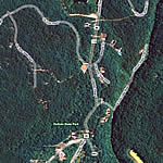
|
Google Directions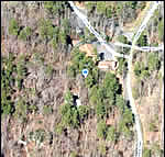
|
|
GO PRO Videos with Elevation Overlays(best viewed in 720p) |
||
Desoto Family Trail |
||
|
|
||
Trail Website:Desoto State Park Hiking Trails |
|
Total Miles:19 miles |
|
Surface Type:Dirt |
|
Primary Use:Hiking, Mountain Biking, Trail Running |
|
Trail Hours:7am till sunset |
|
Directions to Trail:I-59 exit 218 south on Hwy 35; left on Hwy 89 (Desoto Pkwy NE) into the park |
|
Latitude:34.495955Longitude:-85.618580 |
|
Trail Amenities |
|
Trail Restrooms:Yes - within the State ParkTrail Information Center:YesPicnic Area:Yes - throughout parkGroup Pavilion:YesPlaygrounds:Yes |
Beach:No - Swimming available at swimming pool (seasonal).Fishing:Yes - In Little RiverGeocaching:Yes - GPS quest marker system setup throughout park (see website for details).Other Facilities:Many State Park facilitiesTrail User Fee:Park entry fee |
Who’s responsible for Trail? | |
Organization:Alabama Park Service 13883 County. Road. 89 Fort Payne,AL35967 Phone:800-568-8840 or 1-8Fax:256-845-8286Email:DeSoto.StatePark@dcnr.alabama.gov |
|