 |
Bee Branch Canyon Trail (#204) |
County:LawrenceLocation:Bankhead National ForestDescription:Easy hike except one hill near Big Tree. North end branches off Bunyon Hill Trail (#224) with the south end accessed from the Sipsey River Trail (#209). Spectacular views with bluffs; waterfalls (usually) and the popular 'Big Tree'; the largest Yellow Poplar in Alabama; about 150 feet high and 25 feet in circumference. Some camping spots exist; but better sites can be found at the south end by the river. Trail accessible by three mile hike from either Braziel, Borden or Thompson Trailheads. |
Map Links: |
||
|
Satelite view (Map of all trails) 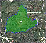
|
U.S.Forest Service Sipsey Wilderness map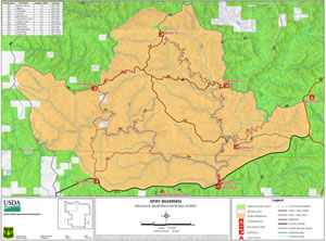
|
|
Total Miles:2.6 miles |
|
Surface Type:Dirt |
|
Primary Use:Hiking Only |
|
Trail Hours:Always open |
|
Trail Connections:Bunyon Hill (#244) and Sipsey River (#209) trails |
|
Directions to Trailheads in Sipsey Wilderness: | |
|
Braziel Trailhead Thompson Trailhead Randolph Trailhead Sipsey River Trailhead Flanigan Trailhead Borden Trailhead Gum Pond Trailhead |
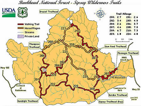 |
Trail Restrictions:See Forestry website: USFS Bankhead National Forest |
|
Latitude:34.30609771Longitude:-87.40134716 |
|
Who’s responsible for Trail? |
|
Organization:USDA Forest ServiceWebsite:USDA Forest Service, Bankhead National Forest |