 |
Braziel Creek Trail (#207) |
County:LawrenceLocation:Bankhead National ForestDescription:4.6 mile Hiking only trail. Moderate to difficult trail from the Borden Trailhead on the south ending into the Northwest Trail (#208) about a half mile west of the Gum Pond Trailhead on the north end. At the south end the trail follows along Braziel Creek leading to the north where you find yourself below the jutted rocks near the top of the bluff. The trail features some of the best scenic views of the wilderness. |
Map Links: |
||
|
Satelite view (Map of all trails) 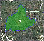
|
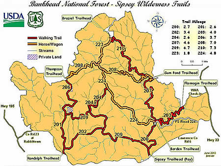
U.S.Forest Service Sipsey Wilderness map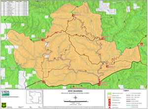
|
|
Trail Website:AllTrails.com Braziel Creek Trail |
|
Total Miles:4.6 miles - From Borden Trailhead to Gum Pond Trailhead |
|
Surface Type:Dirt |
|
Primary Use:Hiking Only |
|
Trail Hours:Always open |
|
Trail Connections:Borden Creek (#200), Lookout (#203, Northwest (#208) and Mitchell Ridge (#210) |
|
Directions to Trailheads in Sipsey Wilderness: |
|
|
Braziel Trailhead Thompson Trailhead Randolph Trailhead Sipsey River Trailhead Flanigan Trailhead Borden Trailhead Gum Pond Trailhead |
 |
Trail Restrictions:See Forestry website: USFS Bankhead National Forest |
|
Latitude:34.30609771Longitude:-87.40134716 |
|
Who’s responsible for Trail? |
|
Organization:USDA Forest ServiceWebsite:USDA Forest Service, Bankhead National Forest |