 |
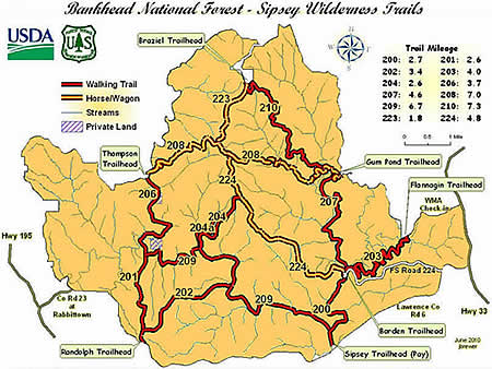
Northwest Horse and Wagon Trail (#208) |
County:LawrenceLocation:Bankhead National ForestDescription:Easy to moderate trails from the Gumpond Trailhead on the East to the Thompson Trailhead on the West. One of the original thoroughfares through the wilderness; this trail is suitable for horses and horse-drawn wagons. Often used as a connector trail as it joins with the Braziel Creek (#207); Mitchell Ridge (#210); Bunyan Hill (#224) and the Gum Pond (#223) trail. |
Map Links: |
||
|
Satelite view (Map of all trails) 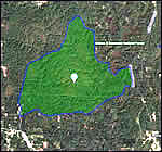
|
U.S.Forest Service Sipsey Wilderness map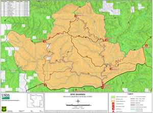
|
|
Total Miles:7 miles from Thompson Trailhead to Gum Pond Trailhead |
|
Surface Type:Dirt |
|
Primary Use:Hiking, Equestrian |
|
Trail Hours:Always open |
|
Trail Connections:Thompson Creek (#206); Gum Pond (#223); Bunyan Hill (#224); Mitchell Ridge (#210) and Braziel Creek (#207) trails |
|
Directions to Trailheads in Sipsey Wilderness: |
|
|
Braziel Trailhead Thompson Trailhead Randolph Trailhead Sipsey River Trailhead Flanigan Trailhead Borden Trailhead Gum Pond Trailhead |
 |
Trail Restrictions:See Forestry website: USFS Bankhead National Forest |
|
Latitude:34.30609771Longitude:-87.40134716 |
|
Who’s responsible for Trail? |
|
Organization:USDA Forest ServiceWebsite:USDA Forest Service, Bankhead National Forest |