 |
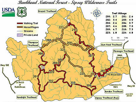
Randolph Trail (#202) |
County:LawrenceLocation:Bankhead National ForestDescription:Easy to moderate trail with the west end using an old road and passing between two cemetaries and the east end passing through a canyon and along a bluff. Accessible from the Randolph Trailhead. Camping is limited along the trail but better camping along the river and in the canyon nearby is available. |
Map Links: |
||
|
Satelite view (Map of all trails) 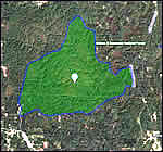
|
U.S.Forest Service Sipsey Wilderness map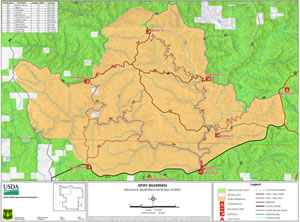
|
|
Trail Website:AllTrails.com Randolph Hiking Trail |
|
Total Miles:3.3 miles to connection with other trails. |
|
Surface Type:Dirt |
|
Primary Use:Hiking Only |
|
Trail Hours:Always open |
|
Trail Connections:Rippey (#201) and Sipsey River (#209) trails |
|
Directions to Trailheads in Sipsey Wilderness: |
|
|
Braziel Trailhead Thompson Trailhead Randolph Trailhead Sipsey River Trailhead Flanigan Trailhead Borden Trailhead Gum Pond Trailhead |
 |
Trail Restrictions:See Forestry website: USFS Bankhead National Forest |
|
Latitude:34.30609771Longitude:-87.40134716 |
|
Who’s responsible for Trail? |
|
Organization:USDA Forest ServiceWebsite:USDA Forest Service, Bankhead National Forest |