 |
Rippey Trail (#201) |
County:LawrenceLocation:Bankhead National ForestDescription:Easy well marked trail accessible from south at Randolph Trailhead. Splits into the Thompson Creek Trail (#206) and Sipsey River Trail (#209). Hikers can visit the abandoned Rippey cabin which is located on private land just northeast of the three trail junction. Some camping available along trail. |
Map Links: |
||
|
Satelite view (Map of all trails) 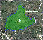
|
U.S.Forest Service Sipsey Wilderness map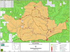
|
|
Total Miles:1.9 miles |
|
Surface Type:Dirt |
|
Primary Use:Hiking Only |
|
Trail Hours:Always open |
|
Trail Connections:Thompson Creek (#206); Sipsey River (#209) and Randolph (#202) trails |
|
Directions to Trailheads in Sipsey Wilderness: |
|
|
Braziel Trailhead Thompson Trailhead Randolph Trailhead Sipsey River Trailhead Flanigan Trailhead Borden Trailhead Gum Pond Trailhead |
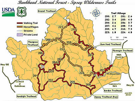 |
Trail Restrictions:See Forestry website: USFS Bankhead National Forest |
|
Latitude:34.30609771Longitude:-87.40134716 |
|
Who’s responsible for Trail? |
|
Organization:USDA Forest ServiceWebsite:USDA Forest Service, Bankhead National Forest |