 |
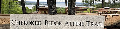
Cherokee Ridge Alpine Trail |
County:TallapoosaCity:Cherokee BluffsLocation:Overlook Drive near Lake Martin DamDescription:Aproximately 11 miles of wooded trails with some along the waterfront of Lake Martin and some overlooking the lake. |
Map Links: |
||
|
Satelite view (Map of all trails) 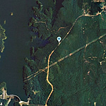
|
Google Birds-Eye-View (Directions) 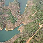
|
|
Trail Website:Cherokee Ridge Alpine Trail |
|
2nd Trail Website:TheRiverRegionOnline.com Cherokee Ridge Page |
|
Total Miles:11 miles |
|
Surface Type:Dirt |
|
Primary Use:Hiking |
|
Trail Hours:Always open |
|
Directions to Trail:From West; Hwy 50 until you cross Tallapoosa river just below Lake Martin Dam about .3 miles turn left on Overlook Dr; go 1 mile to parking area on the left. For `Deadening Trail` trailhead; continue for another 2 miles and look for the signs. |
|
Trail Restrictions:Hiking only, not suitable for mountain biking |
|
Latitude:32.691110Longitude:-85.899755 |
|
Trail Amenities |
|
Trail Restrooms:NoTrail Information Center:YesPicnic Area:Yes - located at trailheadGroup Pavilion:NoPlaygrounds:No - |
Trail Shelter:NoBeach:NoFishing:Yes - Part of trail along waterfrontTrail User Fee:No |
Handicap Accessibility? | |
Trailhead:Yes | |
Trail Segments:No | |
Entire Trail:No | |
Who’s responsible for Trail? | |
Organization:Cherokee Ridge Alpine Trail Association P. O. Box 240503 Eclectic,AL36024 Email:crata.org@gmail.comWebsite:http://cherokeeridgealpinetrail.org/ |
|